Expeditions
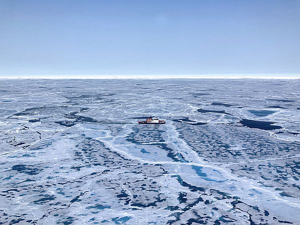
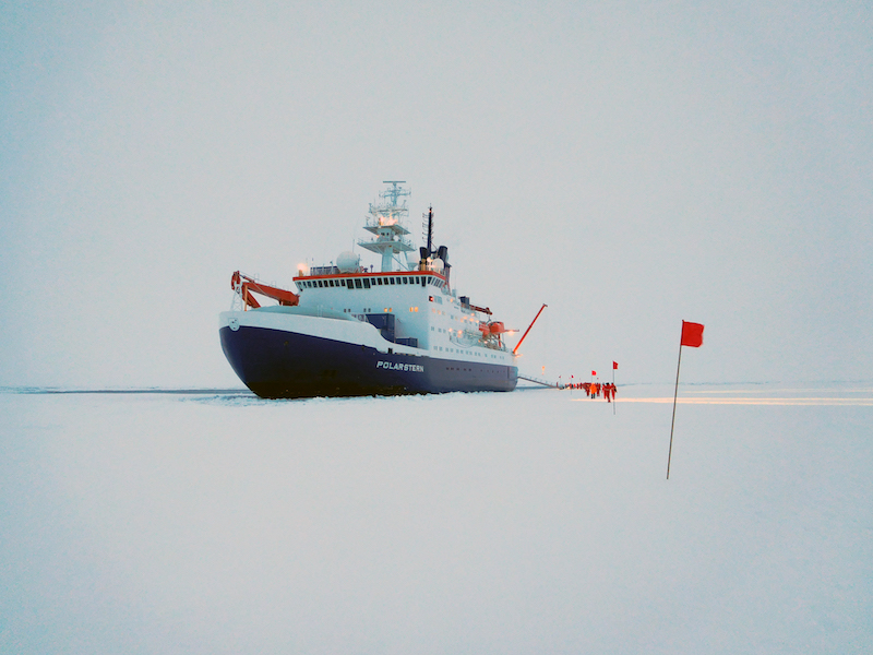
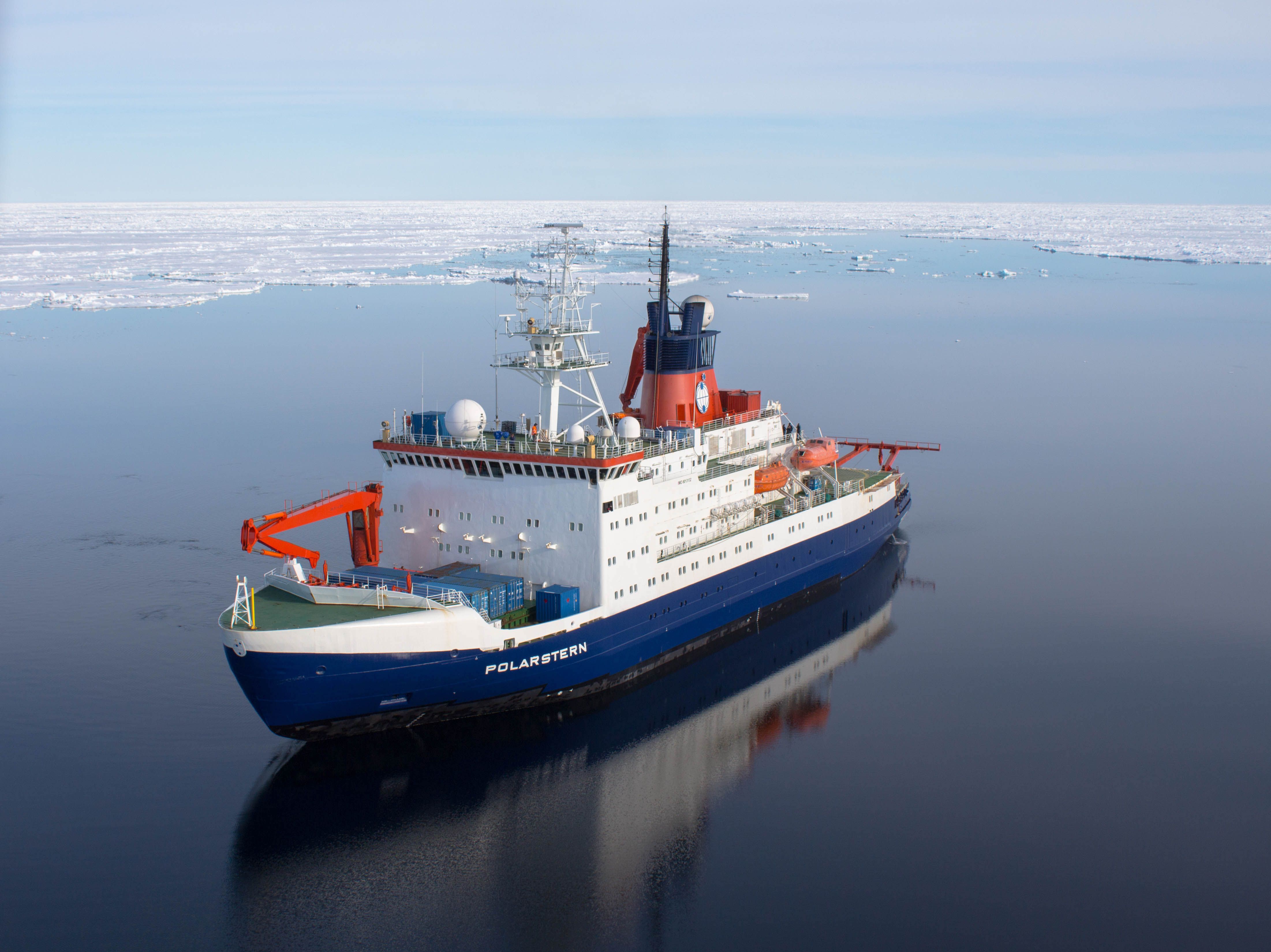
PS137 - Expedition to the Gakkel Ridge and Lena Trough with FS Polarstern
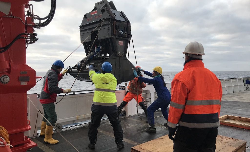
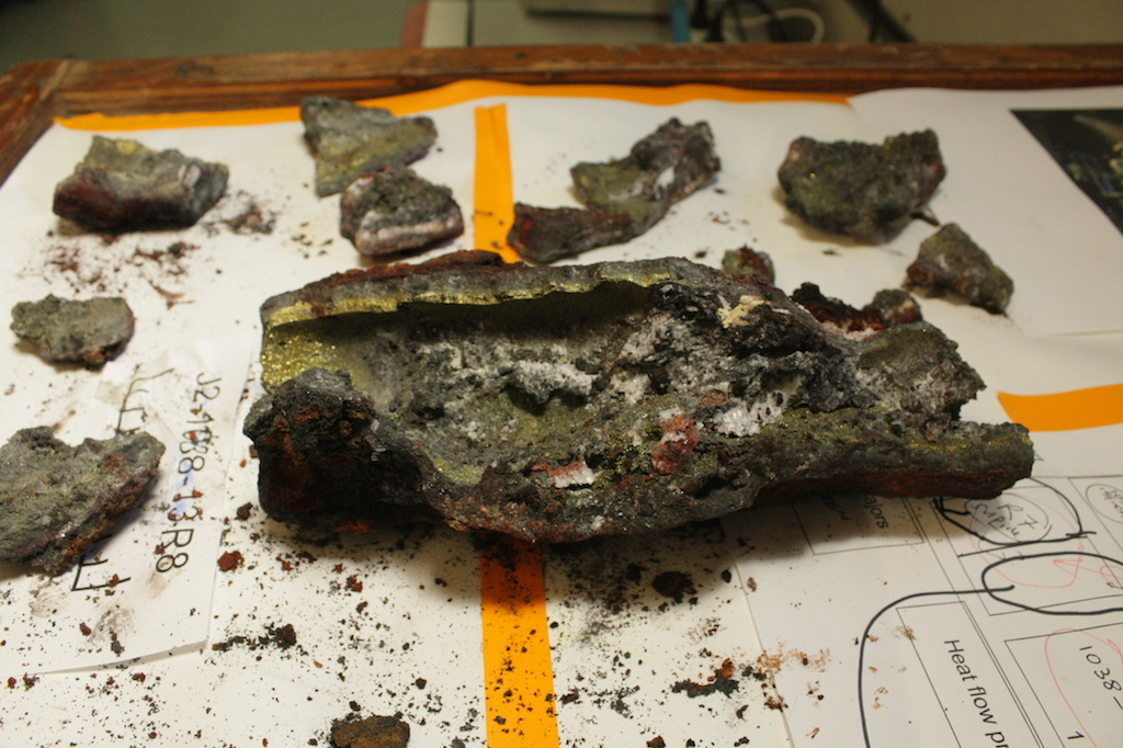
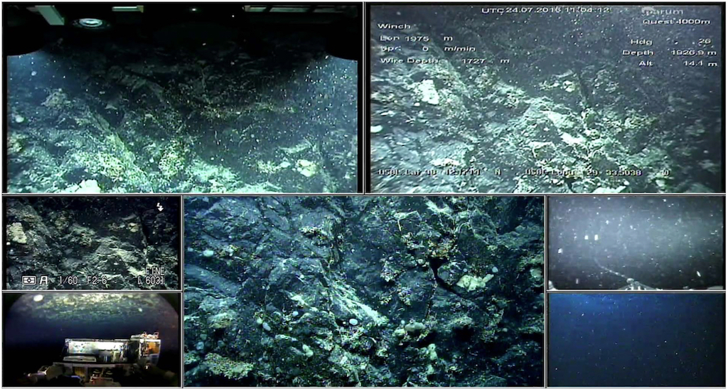
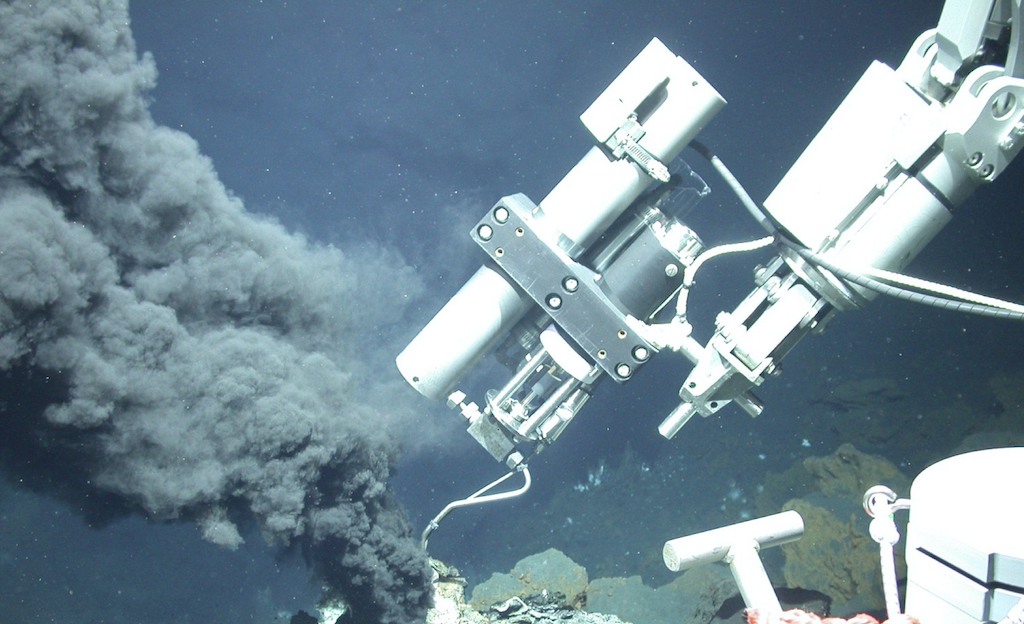
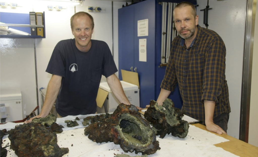
Expedition PS137, named ALOIS (Arctic Lithosphere-Ocean Interaction Study), aimed to study the formation of new lithosphere and the associated hydrothermal circulation at the ultra-slow-spreading Gakkel Ridge and Lena Trough in the Arctic Ocean.
The main interest of the petrology team was the collection of rocks and hydrothermal precipitates as well as hydrothermal fluid and plume samples from the "Aurora" and "Lucky B" hydrothermal systems.

M155 - Expedition to Fogo (Cape Verde Islands)
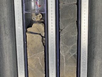
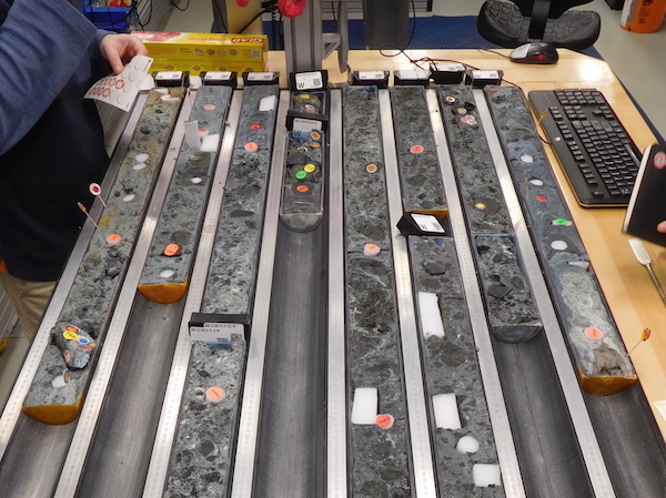
The main objective of the meteor expedition M155 was to study the deposits of a flank collapse of the Fogo volcano (Cape Verde Islands), which triggered a mega-tsunami about 73,000 years ago.
The image shows an example of a gravity core from the southern study area with different background sedimentation (beige to reddish colors) and different layers rich in volcanoclastic sand.

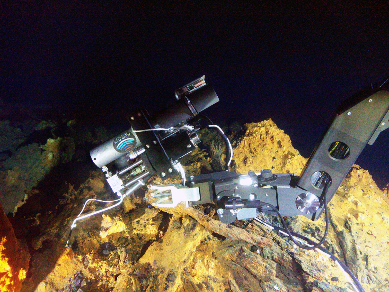
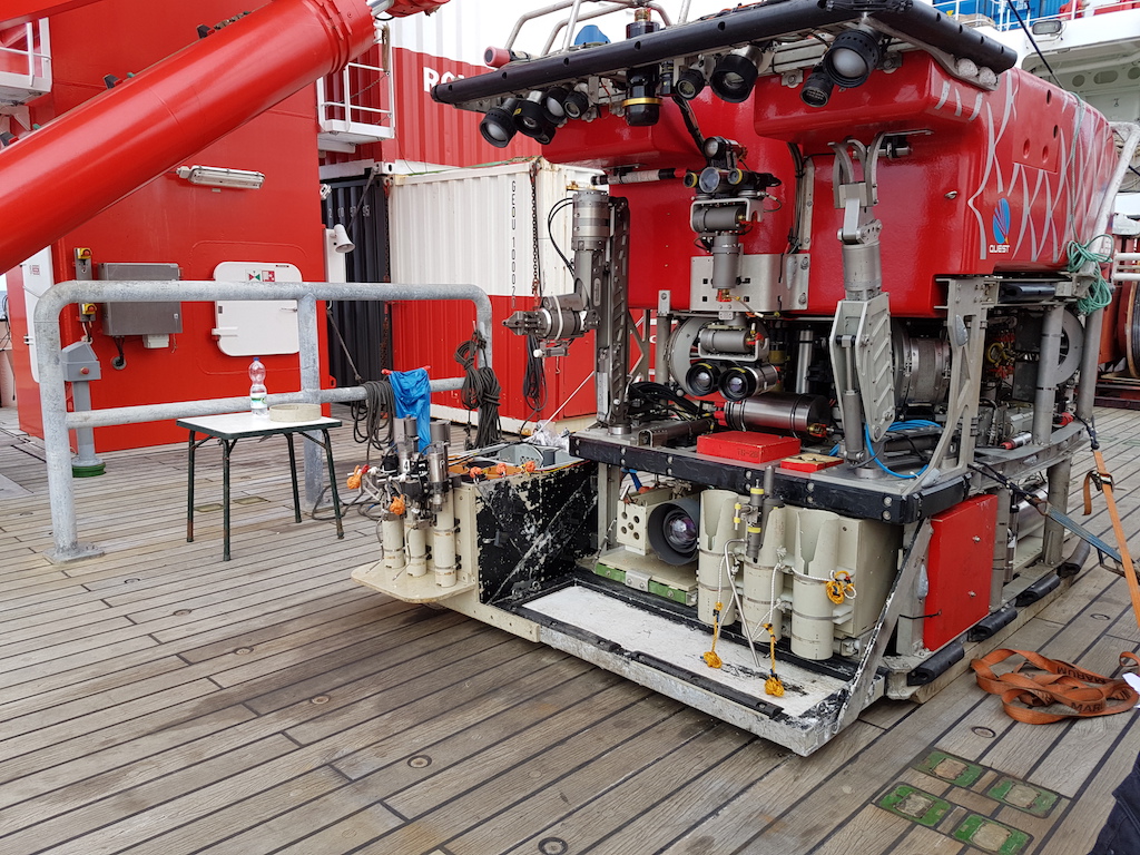
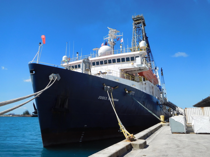
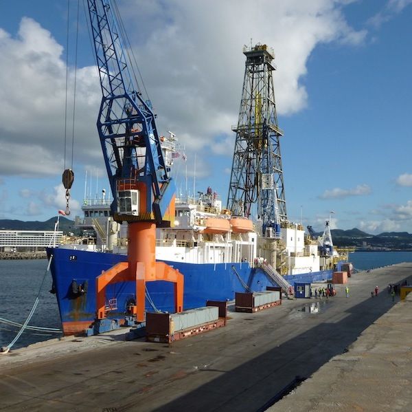
SO253 - Cruise to the South Kermadec Island Arc
On R/V Sonne Expedition SO253, four hydrothermally active volcanoes in the southern Kermadec Island Arc (Brothers Caldera, Haungaroa Volcano, Macauley Caldera, Rumble III) were visited and sampled using the remotely operated underwater vehicle MARUM Quest 4000.
The aim was to find out how fast hydrothermal plumes propagate in the ocean and what processes take place when the escaping hot solutions mix with the ocean water masses.

Location: Shallow water hydrothermal vents off Milos; Piraeus (Greece) - Limassol (Cyprus)
Date: August 8 — September 5, 2023
Funding: DFG
Participants from our group: Solveig Bühring, Wolfgang Bach, Charlotte Kleint, Palash Kumawat
Summary: Expedition M192 investigated submarine hydrothermal activity in the transition between shallow and deep water, and the influence of water depth on biological processes off the Greek island of Milos. One objective was to document geochemical changes in fluids and associated microbial diversity with increasing depth and distance from land, and to investigate the relative importance of chemosynthesis and animal dependence on symbiotic associations with microorganisms with increasing depth. To date, shallow-water and deep-sea hydrothermal systems have been treated as independent, seemingly unrelated entities; this expedition is a first attempt to remove this arbitrary boundary and study hydrothermal systems as a continuum.

Location: Hydrothermal vents at the Mid-Atlantic Ridge 29-38°N; Las Palmas (Spain) - Algeciras (Spain)
Date: June 8 — July 10, 2023
Funding: DFG-EXC
Participants from our group:Wolfgang Bach, Patrick Monien, Alexander Diehl
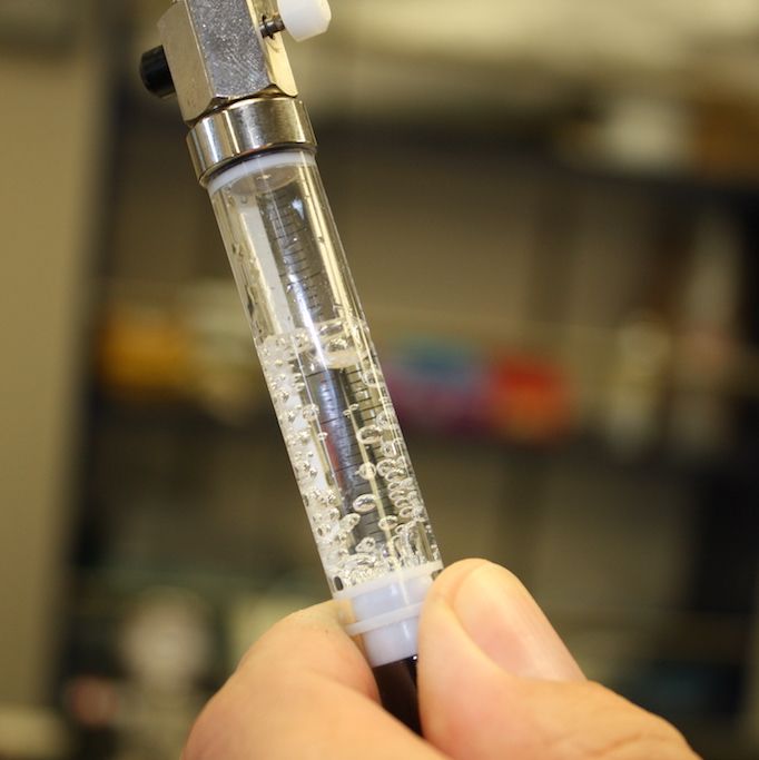
Summary: Cruise M190 of R/V Meteor was carried out in order to be able to take geochemical and biological samples at hydrothermal vents on the Mid-Atlantic Ridge between 29°10''N and 38°20''N. The springs in this area are characterized by very different geological settings, and the fluids are correspondingly very different in nature. The hydrothermal vents were sampled with the ROV MARUM Quest 4000 to determine the material differences between the individual vents and to place them in relation to the geological framework. We also want to investigate how the distribution and composition of the sources affect the genetic and metabolic diversity of symbiotic and free-living microorganisms. Surveying and sampling the water column and subsequent geochemical analyses will reveal how metals are introduced into the ocean and how their binding modes change. Extensive sampling and investigation of diffuse sources will provide insight into the activity of intracrustal microorganisms and their metabolic strategies. A total of 12 dives with the ROV MARUM Quest 4000 and eleven CTD stations, five of them combined with deep-sea pumping, provided sufficient samples to address the scientific questions. In addition, we surveyed unmapped seafloor in several regions with the EM122 multibeam echo sounder and tried to detect bubble trails in the water column to find additional hot springs in volcanic edifices around 38°N.
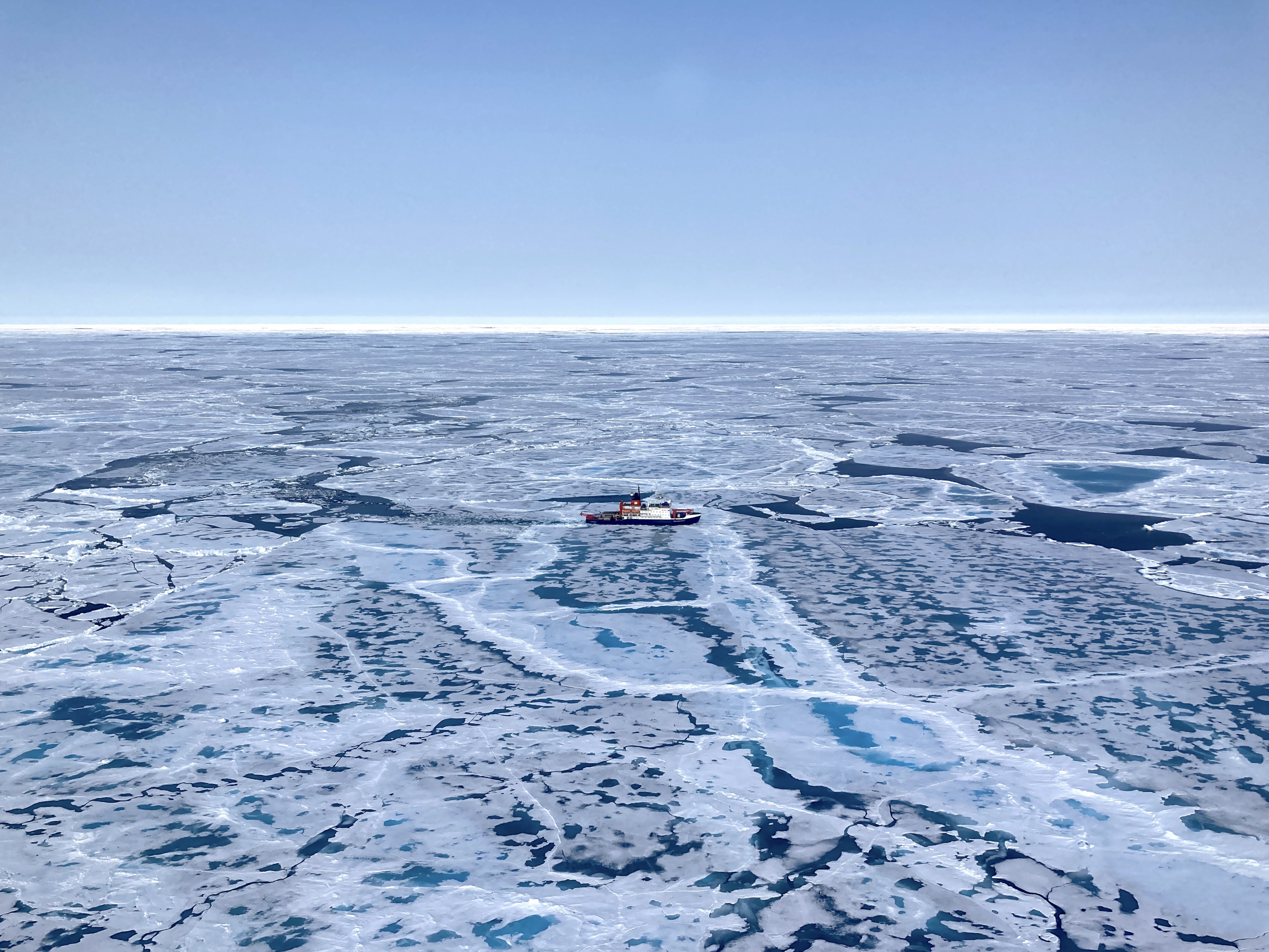
Location: Gakkel Ridge & Lena Trough; Tromsø (Norway) – Tromsø (Norway)
Date: June 21, 2023 — July 31, 2023
Funding: ...
Participants from our group: Elmar Albers
Summary: Expedition PS137, named ALOIS (Arctic Lithosphere–Ocean Interaction Study), aimed at investigating the formation of new lithosphere and associated hydrothermal circulation at the ultraslow-spreading Gakkel Ridge and Lena Trough, Arctic Ocean. The main interest of the petrology team was the collection of rocks and hydrothermal precipitates as well as hydrothermal fluid and plume samples from the ‘Aurora’ and ‘Lucky B’ hydrothermal systems.

Location: East flank of the Reykjanes Ridge at 58°N; Ponta Delgada (Azores, Portugal) - St. John's (Newfoundland, Canada)
Date: July 13 — August 9, 2023
Funding: DFG-EXC
Participants from our group: Wolfgang Bach, Isabel Lange, Aaron Röhler, Paul Berndt
Summary: Cruise M183 took place to conduct site survey work at the eastern flank of the southernmost Reykjanes Ridge to identify potential targets for MeBo-drilling and ridge flank observatory installation. Survey data to be collected included multibeam echosounding and subbottom profiling, porewater analyses of cored sediment, and temperature measurements in the shallow subseafloor. The survey work began in the area between 58°00'N, 32°W and 58°10'N, 31°W but suitable sediment ponds were not found in that section of the ridge flank. We were successful in identifying the third pond we visited as promising target for MeBo drilling and ridge flank observatory installation. In this sediment pond (named Squid Pond by us) 107 giant heat flow probe deployments yielded a tight data grid that clearly suggests significantly higher heat flow on the northwestern side of the pond and the adjacent ridge than in the respective counterparts on the southeastern side of the sediment pond. After two subbottom profiling dives with ROV MARUM SQUID, the robot was used in and around Squid Pond to collect rocks and push-core sediments. Twelve gravity cores were taken; the most common type of sediment is sandy muds with variable color (dominantly grayish brown to greenish gray) and fluctuating fractions of foraminiferal sand and dropstones. Sediment pore water samples were retrieved and analyzed for oxygen and iron concentrations as well as total alkalinity. The combined data and observations are consistent with an upward-directed flow of basement fluids in the ridge bounding Squid Pond to the northwest.
Location: South Atlantic Transect II; Cape Town (South Africa) – Cape Town (South Africa)
Date: Juni 7, — August 7, 2022
Funding: IODP
Participants from our group: Elmar Albers
Summary: The South Atlantic Transect is a multidisciplinary ocean drilling project that included two IODP expeditions (Exp. 390 & 393) at which sediments and up to 200 m of the underlying basaltic crust were drilled along a Mid-Atlantic Ridge crustal flow line. Sediments and basement were recovered at 7, 15, 31, 49, and 61 Ma old sites, to investigate the evolution of deep-water masses and past climatic changes, microbiology of sediments and crust, as well as hydrothermal interactions between the aging oceanic crust and the evolving South Atlantic.
Location: Marion Rise, Southwest Indian Ridge; Cape Town (South Africa) – Emden (Germany)
Date: March 6, — April 22, 2020
Funding: BMBF
Participants from our group: Elmar Albers, Christian Hansen, Katharina Unger-Moreno
Summary: Departing from Cape Town with a magnificent view of the Table Mountain, expedition SO273 set out to investigate the igneous, tectonic and hydrothermal processes at the Marion Rise along the ultraslow spreading Southwest Indian Ridge (SWIR). The Marion Rise represents an area of anomalously shallow bathymetry and one of the largest rises in the global oceanic ridge system. An interdisciplinary group of geologists, geochemists, and geophysicists from Berlin, Boston, Bremen, Erlangen, Hanover, Helsinki, Laramie, Modena, Münster, and Tallahassee cooperated onboard research vessel Sonne to unravel the origin of this peculiar feature in the Southern Indian Ocean. A detailed view of submarine geological features was acquired with a range of remote sensing methods including bathymetric, gravimetric and magnetometric surveys. A comprehensive set of rock samples was acquired via dredging and during targeted dives using the remotely operated underwater vehicle MARUM QUEST 4000. Samples included pillow basalts, peridotites, alkali basalts, carbonates, and ultramylonitic peridotites from volcanically active to amagmatic ridge segments as well as the first oriented samples from the SWIR. Miniature autonomous plume recorders were deployed with dredges and during ROV dives and complemented with CTD surveys including volatile measurements (hydrogen, methane) in order to explore hydrothermal activity. The recovered samples and the acquired geophysical data will be used to decide whether the Marion Rise rather formed from isostatic upwelling of ancient residual mantle material or from excess melting during plume-ridge interaction. Due to globally increasing travel restrictions in context of the SARS-CoV-2 pandemic SO273 expedition was aborted on the 21st of March with R/V Sonne heading back to Emden (Germany) unfortunately cutting most of the planned research.
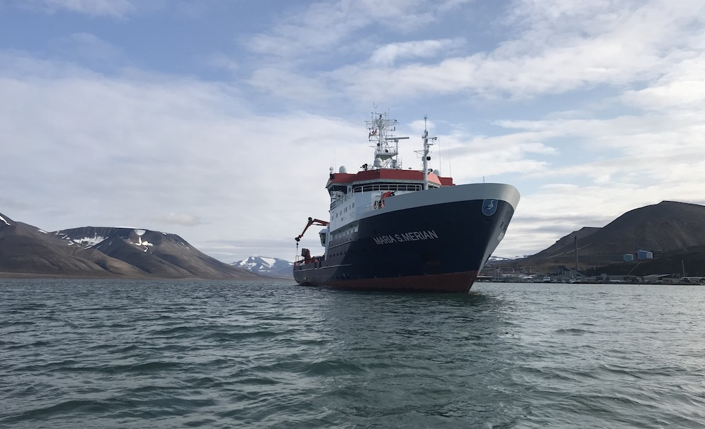
Location: Vesteris Seamount, Greenland Sea; Longyearbyen (Norway) – Emden (Germany)
Date: August 18, 2019 — September 16, 2019
Funding: DFG
Participants from our group: Wolfgang Bach, Katharina Unger-Moreno
Summary: Vesteris Seamount is a young and large intraplate volcano located in the Greenland Sea, which erupted many times in the past 500,000 years and is considered presently dormant. Its composition is strange for a volcano this size and rather resembles that of very small volcanic fields. A multidisciplinary and multinational approach in which geologists, geobiologists and geophysics from Bremen, Erlangen, Kiel, Göttingen, Hamburg, Bergen, Helsinki, Stockholm, and Vienna were involved was aimed at improving our understanding of the evolution of this seamount. During cruise MSM86, detailed topographic maps were produced using the modern echosounding systems of our research vessel, the Maria S. Merian. These maps show lava flows, lava fountaining deposits, and landslides that shaped this enigmatic volcano. Moreover, a large number of samples including rocks and biota were collected with a TV-guided grab and during several dives with the ROV (Remotely Operated Vehicle) MARUM-SQUID. Subsequent comprehensive geochemical and (micro)biological analyses will give more insights into mantle melting dynamics and source composition and the geodynamic evolution of the northern North Atlantic, the constructional history of this volcano as well as the diversity of local sponges and the microbiomes they host. Finally, by examining the colonization of volcanic rocks by microorganisms, including fungi and bacteria, we may learn more about the relationship between rock alteration and endolithic life.


Location: Fogo, Cape Verde Islands; Pointe-à-Pitre (Guadeloupe) – Mindelo (Cape Verde)
Date: May 26, 2019 — June 30, 2019
Funding: DFG
Participants from our group: Andreas Klügel
Summary: The main objective of Meteor cruise M155 was to investigate the deposits of a giant flank-collapse of Fogo Volcano (Cape Verde Islands) causing a mega-tsunami approximately 73,000 years ago. On nearby Santiago Island tsunami deposits had been found indicating run-up heights of more than 270 m. Hydroacoustic and seismic data were collected to determine and quantify the geometry, extension, volume, sedimentological characteristics and stratigraphy of these deposits. The hydroacoustic data revealed that the mass transport deposits cover an area much larger than previously postulated. Most of the mass transport deposits are related to volcanic flank collapses but additional landslide deposits were identified north and south of Fogo. Moreover, seismic data show several widespread buried mass transport deposits indicating that the most recent collapse was not a unique event. In addition, a total of 32 sediment cores were taken in this area and examined for volcaniclastic turbidites probably related to volcanic eruptions. These turbidites will give us clues on the timing, volume and temporal recurrence of the collapse events.
Further information about expedition M155 in the cruise report
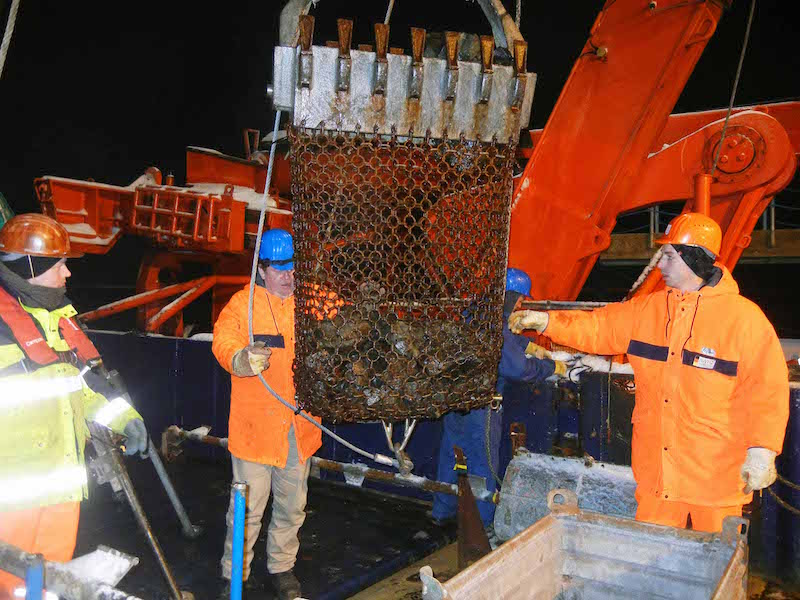
Location: South Sandwich arc, East Scotia ridge; Punta Arenas (Chile) – Port Stanley (Falkland, UK)
Date: April 13, 2019 — May 31, 2019
Funding: BMBF
Participants from our group: Alexander Diehl, Samuel Pereira
Summary: In the mid of April 2019 the research vessel Polarstern has steamed-off to its last expedition prior to the big MOSAIK project. The vessel set out to a seven-week lasting research expedition in the Scotia Sea. Aim of the expedition was to explore the sparsely known plate boundaries, the South Sandwich arc and the East Scotia ridge. The research program was designed manifold and included the registration of whale migration routes, mapping surveys at Saunders volcano, sediment sampling at the continental shelf off South Georgia, and the exploration and investigation of marine hydrothermal vents in intra-oceanic arcs and back-arc spreading centers. Despite a rough sea state during the expedition ROV QUEST 4000 (MARUM) could sample hydrothermal vents from the E2-segment of the East Scotia ridge, as well as the South Sandwich arc volcano Kemp Caldera. The sampled hydrothermal fluids and precipitates could not be more different. High temperature black smoker fluids (> 320 °C), which precipitate large sulfide chimneys when entering the ocean at the E2-segment, are in contrast to lower temperature white smoker vents (<230 °C), which are sometimes accompanied by the discharge of liquid sulfur in Kemp Caldera. Our investigations aim to put our samples into context of the few existing samples from the different working areas and evaluate whether these geologic systems have changed their dynamics or remained stable in terms of energy and chemistry. Furthermore, we examine the differences between these vents from intra-oceanic arc and back arc spreading environments, that represent two extreme types of venting.
Location: Tonga-Rift; Suva (Fiji) – Suva (Fiji)
Date: 1. Juni 2018 — 27. Juni 2018
Funding: BMBF
Participants from our group: Wolfgang Bach, Alexander Diehl, Patrick Monien, Stefan Sopke, Andreas Türke
Summary: Expedition SO263 with research vessel Sonne and ROV MARUM Quest 4000 was carried out from the sun-kissed islands of Fiji to investigate the volcanic, hydrothermal und tectonic history of the Tonga intra-oceanic arc and its back-arc spreading center. During the expedition several hydrothermal vent fields have been investigated at the Niua and Niuatahi arc volcanoes and at the back-arc volcano Maka. Our research agenda comprised of extensive sampling of volcanic rocks and the investigation of hydrothermal fluids, sulfides and chemosynthetic vent communities. The agenda was supplemented by CTD and MAPR investigations of plume dispersal in the water column. The chosen research area provides the opportunity to investigate the evolution of magmatic melts at convergent plate boundaries behind subduction zones. The associated hydrothermal systems are situated in different geologic environments and enable us to study the differences between vent fluids at intra-oceanic arcs and back-arc spreading centers. The implemented research agenda with a coupled investigation of volcanic rocks and hydrothermal processes enables us to profoundly learn about the relationship between magmatic activities and subsequent hydrothermal activities in all its facets.
Location: Brothers volcano, southern Kermadec Arc; Auckland (NZ) – Auckland (NZ)
Date: May 5, 2018 — July 5, 2018
Funding: IODP
Participants from our group: Lucy Schlicht
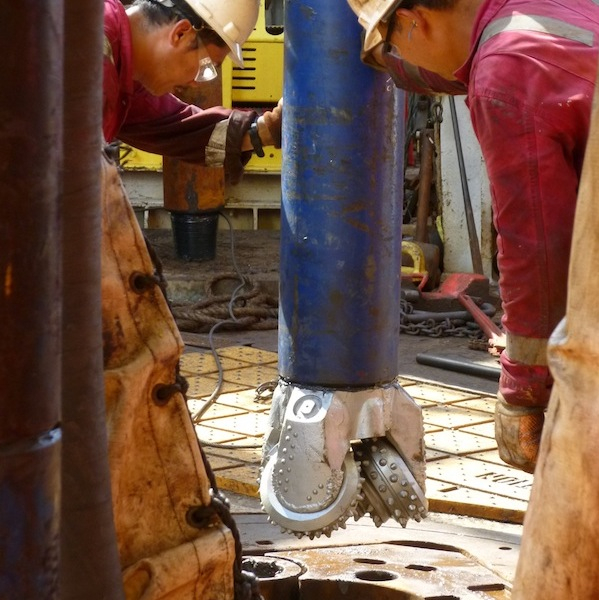
Summary: Deep-sea drilling of dacitic rocks that were heavily affected by hydrothermal alteration at the NW Caldera and Upper Cone sites of the Brothers volcano, southern Kermadec Arc. Investigations are used for deeper understanding of hydrothermal activity in arc settings, from petrological, geochemical, geophysical, and microbiological point of views.

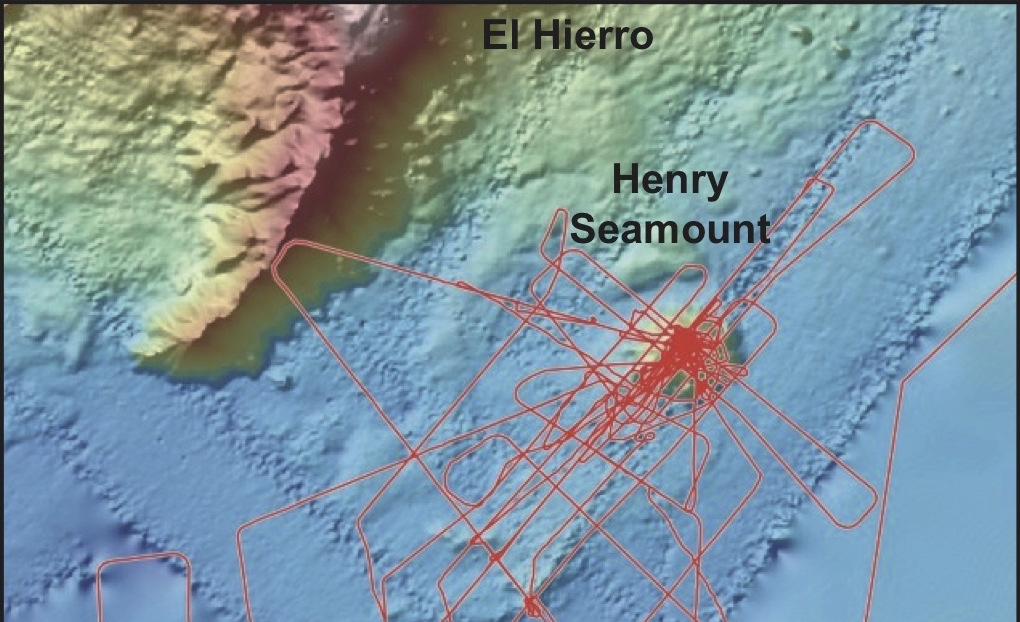
Location: Henry Seamount; Recife (Brazil) – Las Palmas (Gran Canaria, Spain)
Date: March 17, 2018 — April 16, 2018
Funding: DFG
Participants from our group: Andreas Klügel
Summary: The R/V METEOR-cruise M146 was carried out at Henry Seamount, an extinct volcano located ca. 40 km southeast of El Hierro, Canary Islands. The objective of this cruise was to discover sites of hydrothermal circulation of seawater, which is globally important for cooling of the lithosphere, chemical exchange between crust and ocean, and marine ecosystems. This circulation requires basement outcrops that form pathways through impermeable sediment. Data acquired during previous cruise M66/1 showed that Henry Seamount may provide such outcrops. Our methods to find them included 1) high-resolution mapping by AUV; 2) high-resolution seismic reflection profiling to survey thickness and internal structure of sediment layers on and around the seamount; 3) determination of local heat flows to detect heat sinks and sources; 4) TV-sled surveys; and 5) local sampling.
Further information about expedition M146 on the MARUM website and in the cruise report
Location: Brothers volcano; Auckland (New Zealand) – Auckland (New Zealand)
Date: March 6, 2018 — March 26, 2018
Funding: BMBF
Participants from our group: Alexander Diehl
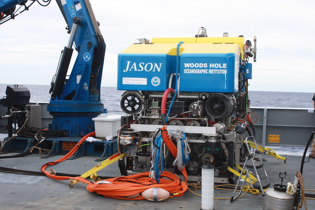
Summary: Cruise TN350 was set out in the course of the preparation of IODP expedition 376 “Brothers arc flux”. Aim of the expedition was to investigate active hydrothermal systems at Brothers caldera, to conduct heatflow measurements and to pre-explore potential drill sites for the upcoming IODP drilling at Brothers volcano. ROV Jason II, operated by the Woodshole Oceanographic Institution, was deployed to recover samples of hydrothermal fluids and precipitates. The fluid sampling was done with isobaric gas tight fluid samplers and the focus was set on the analytics of dissolved volatiles in the hydrothermal fluids. During the expedition multiple samples from various vent sites at Brothers Caldera (NW Caldera site, Caldera Rim, Upper Cone, Lower Cone) were successfully sampled. The samples are used to comprehend existing datasets of hydrothermal fluids from Brothers volcano.
Location: South Kermadec arc; Noumea (New Caledonia) – Auckland (New Zealand)
Date: December 22, 2016 — January 21, 2017
Funding: BMBF
Participants from our group: Wolfgang Bach, Alexander Diehl, Christian Hansen, Stefan Sopke, Janis Thal, Andreas Türke
Summary: The research vessel Sonne visited four hydrothermally active volcanoes (Brothers Caldera, Haungaroa Volcano, Macauley Caldera, Rumble III) in the south Kermadec arc, during expedition SO253. The expedition was set out to investigate how fast hydrothermal plumes disperse in the ocean as hydrothermal solutions mix with seawater. A part of the expedition work was to investigate microbial activities and chemosynthetic communities associated with hydrothermal vents. Furthermore, the main objective was to characterize the physical and chemical circumstances under which the hydrothermal fluids and the associated chemosynthetic communities form. With the help of ROV Quest 4000 (MARUM) we sampled various hydrothermal fluids, hydrothermal precipitates formed from these fluids and volcanic rocks that provided the chemical components for these fluids and precipitates. The samples are used to gain a process understanding of which particular processes are responsible for the unique character of some arc hydrothermal fluids. The investigations of rocks and fluids provide a basis to evaluate how volcanic degassing in the subsurface and phase separation of rising fluids influence the chemical composition of arc hydrothermal solutions.
Location: Yinazao, Asùt Tesoru, and Fantangisña mud volcanoes in the Mariana forearc; Guam (USA) – Hong Kong (People’s Republic of China)
Date: December 08, 2016 — Februar 07, 2017
Funding: IODP
Participants from our group: Elmar Albers
Summary: This expedition to the Mariana forearc in the western Pacific Ocean had the aim to investigate the geochemistry, tectonics, and biology in an active subduction zone. We cored the summits and flanks of three serpentinite mud volcanoes - namely the Yinazao, Asùt Tesoru, and Fantangisña seamounts (formerly known as Blue Moon, Big Blue, and Celestial) - and sampled sediments, rocks, and fluids. These will provide insights into shallow subduction zone processes including, e.g., mass transports and geochemical cycling as well as spatio-temporal variability of subduction-related fluids and water–rock interactions.
Location: Karasik seamount in the Arctic Ocean located at 87°N, 61°E; Tromsø (Norway) – Bremerhaven (Germany)
Date: September 9, 2016 — October 23, 2016
Funding:
Participants from our group: Elmar Albers, Alexander Diehl
Summary: The destination of this expedition was the region of the more than 4000 m high Karasik seamount, which is one of the highest seamounts of the Arctic Ocean. Extensive ocean floor mapping in the course of this cruise revealed Karasik to be part of the Langseth Ridge that meets the ultraslow spreading Gakkel Ridge at about 87°N and 61°E. Our working group is particularly interested in the origin of the Karasik seamount and the Langseth Ridge. Systematic usage of a dredge and gravity corer brought volcanic and plutonic rock samples to deck, as well as rocks that had their origin in or were altered by hydrothermal activity. Together with seafloor image data acquired by OFOS (Ocean Floor Observation System) and NUI (Nereid Under Ice, an hybrid ROV), we could gain valuable insights into the regional geology. A second focus was on studying a nearby active hydrothermal system in the Gakkel Ridge spreading centre. Here, we sampled fresh and hydrothermally altered rocks and sediments from the seafloor, and took water and particle samples from the hydrothermal plume. Images of inactive hydrothermal vents and seepage sites nearby the presumed location of hydrothermal fluid discharge were provided by OFOS.
Location: Azores Plateau in the Atlantic Ocean; Ponta Delgada (Portugal) – Ponta Delgada (Portugal)
Date: July 2, 2016 — July 24, 2016
Funding: DFG
Participants from our group: Wolfgang Bach, Andreas Klügel, Tom Skambraks
Summary: The overarching goal of cruise M128 with research vessel Meteor was to map and sample the oldest and youngest submarine volcanic edifices of the Azores Plateau in order to improve our understanding of the processes involved in the evolution of large oceanic plateaus. Another focus was on the investigation of the young submarine João de Castro seamount located about 100 km northwest of São Miguel island, where hydrothermal activity has been described in the past, and of Serreta volcano off Terceira island where a submarine eruption occurred between 1998 and 2001. By using the MARUM remotely operated underwater vehicle (ROV) QUEST 4000 equipped with high-resolution cameras and sampling devices several rocks, volcanic glasses and biological samples were recovered from these sites. ROV sampling was complemented by a TV grab, a wax corer and hydroacoustic/bathymetric surveys. Miniature autonomous plume recorders were further used to detect potential hydrothermal vents in the young volcanoes of the research area, which, however, could not be confirmed. Subsequent comprehensive petrological and geochemical analyses of rocks and glassy lavas will provide valuable information on the inner structure of the submarine rifts and on the proposed origin of Azores volcanism by a mantle “wetspot”.
Further information about cruise M128 on the website of GeoZentrum Nordbayern and in the cruise report
Location: Logatchev hydrothermal vent field at the Mid-Atlantic Ridge; Fortaleza (Brazil) – Bridgetown (Barbados)
Date: April 19, 2016 — May 21, 2016
Funding: DFG
Participants from our group: Wolfgang Bach
Summary: With a total length of about 20,000 km the Mid-Atlantic Ridge is one of the longest mountain chains on Earth. Located in midst of the Atlantic Ocean ranging from the Arctic to close to the Antarctic, this active spreading ridge hosts many hydrothermal vents where hot (up to 400 °C), methane, hydrogen, and sulfide bearing water provides the basis for a unique and biodiverse ecosystem. The goal of this cruise with the research vessel Meteor was to increase our understanding of the links between geochemical reactions within the seafloor and biological processes at hydrothermal vents. We visited four hydrothermal vent fields located between 12°N and 15°N on the Mid-Atlantic Ridge (Logatchev, Semenov, Irinovskoe, and Ashadze), which differ in seafloor tectonics and basement rock compositions. These differences affect the distribution and composition of hot and diffuse hydrothermal fluids as well as the diversity and distribution of the biological communities. During the cruise, comprehensive sampling of rocks, fluids, and biota was done by the remotely operated vehicle QUEST from MARUM, Bremen. Additionally, a CTD/Rosette sampler equipped with Miniaturized Autonomous Plume Recorders was deployed to analyze the dimensions and the geochemistry of the hydrothermal plumes above the vent fields and to sample their microbial communities. The collected data are analyzed in an integrative manner by an interdisciplinary team of national and international researchers to provide information on the interactions between the lithosphere, hydrosphere and biosphere of hydrothermal vents on the Mid-Atlantic Ridge.
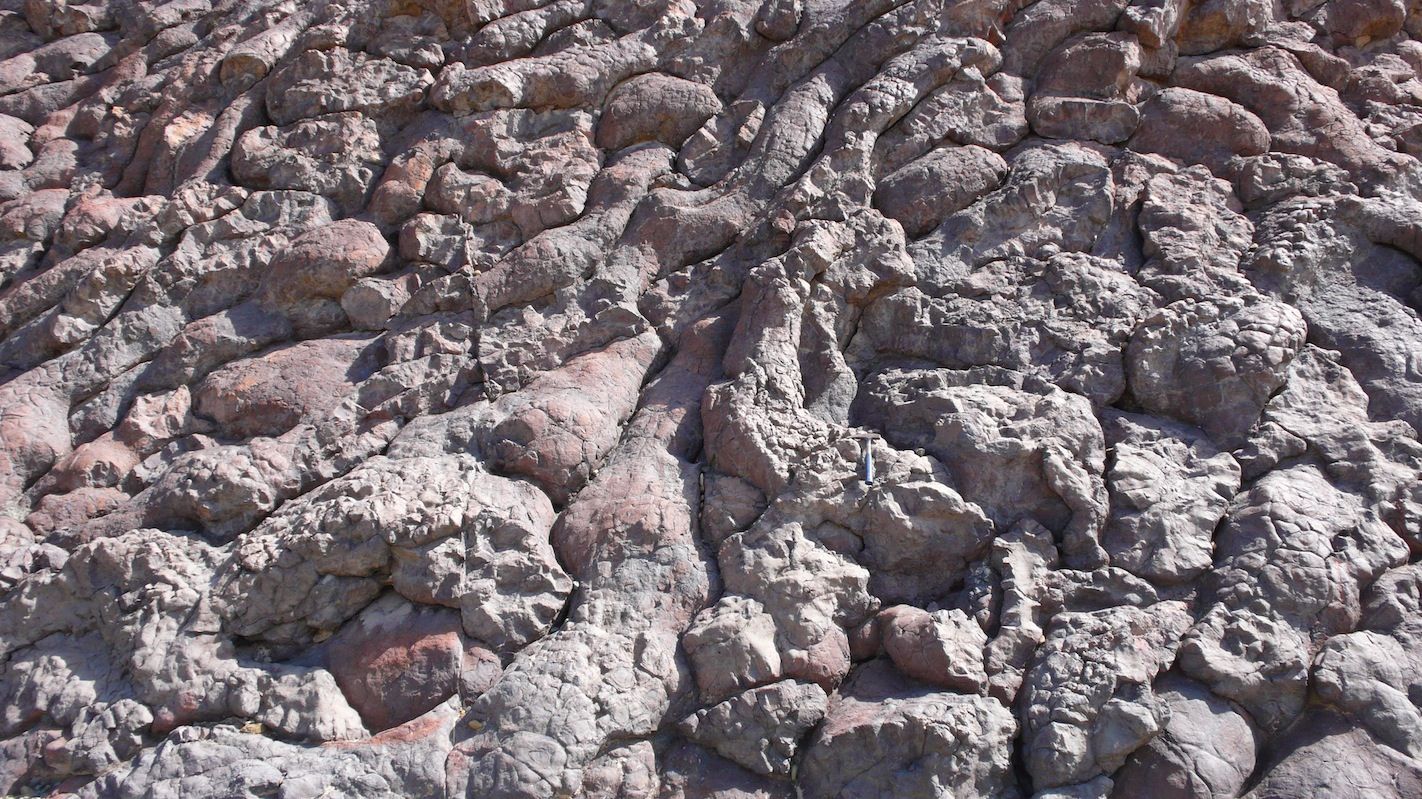
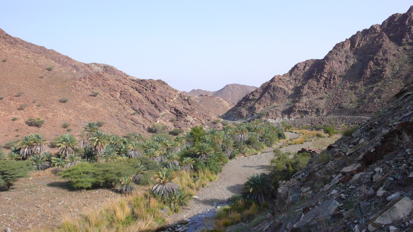
Location: Oman Ophiolite Complex (northern Oman)
Date: February 9, 2015 — Februar 22, 2015
Funding: DFG
Participants from our group: Wolfgang Bach, Bastian Bieseler, Alexander Diehl, Dario Fußmann, Karin Los, Patrick Monien
Location: Aurora sea mount in the Arctic Ocean at 82°N, 6°W; Tromsø (Norway) - Tromsø (Norway)
Date: July 5, 2014 — August 3, 2014
Funding:
Participants from our group: Andreas Türke, Alexander Diehl
Summary: The cruise to the Aurora mount aimed at studying hydrothermal activity in the deep Arctic. The Aurora mount is located at the western edge of the ultraslow spreading Gakkel Ridge and is a volcanic structure in 3800 m water depth, elevated by 400 m from the surrounding seafloor. Hot fluids venting from the mount produce a hydrothermal plume, which was sampled intensively for geochemical (dissolved trace metals, methane) and microbiological studies. Furthermore, mapping of the seafloor was carried out by several Ocean Floor Observatory System dives, which were able to obtain several high resolution images of hydrothermal vents.
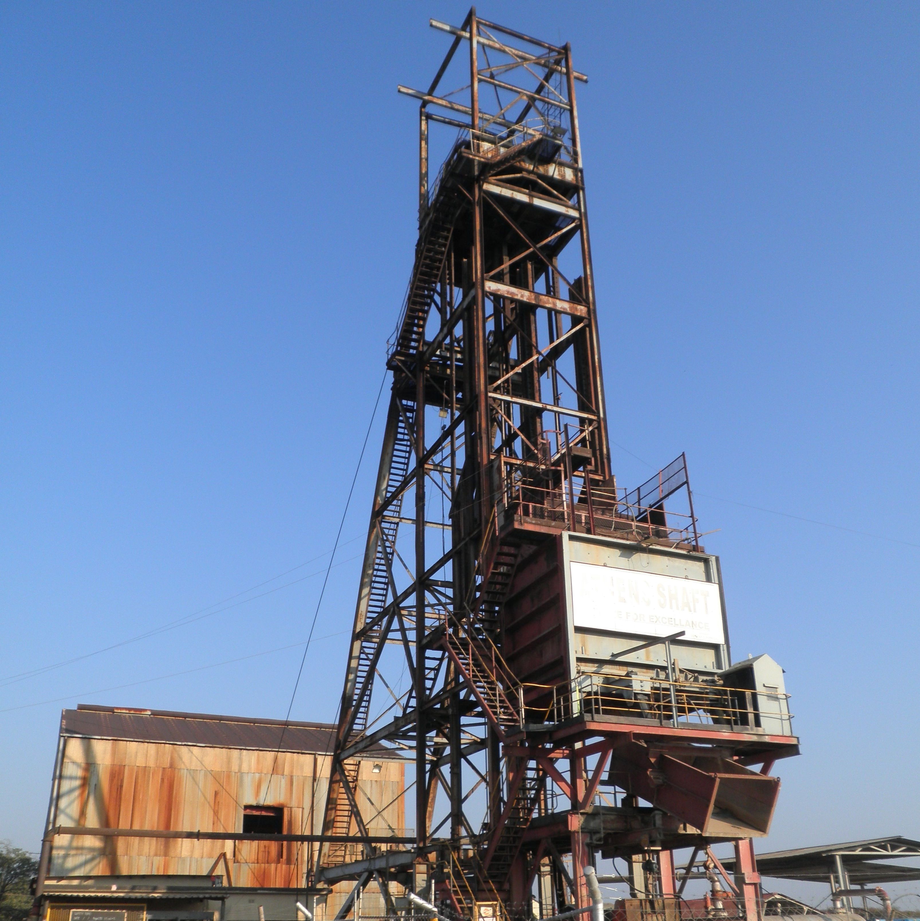
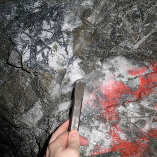
Location: Murchison, South Africa
Date: Mai 5, 2013 — Mai 17, 2013
Funding: BGR
Participants from our group: Nikki Blaauwbroek
Summary: The primary goal of the fieldwork was to collect samples to support the PhD research of Nikki Blaauwbroek, which focuses on the geochemical point of view of the antimony mineralization of the Murchison Greenstone Belt (2.97 Ga), South Africa. The antimony enrichment, mainly found as stibnite (Sb2S3), is focused along the so-called “Antimony Line (AL)” in quartz-carbonate veins. The carbonization of the AL represents a structural and geochemical overprint of the metagranodiorite and metakomatite found along the AL. The close spatial correlation of felsic and ultramafic rocks has been explained by a (back-)arc system from the Archaean, where the granodiorite intruded in the komatiite-rich continental crust by arc-volcanism. The antimony has been successfully mined for over 80 years. At the moment, ConsMurch is mining antimony and gold from four mines: Athens, Beta, Monarch and Gravelotte. The samples have been taken from different locations in relative position of the main ore-“reef”, which is where the highest amount of antimony is found. Major and trace element measurements have been performed with these carbonates, quartz and sulfides as well a stable isotope investigation. Geochemical modeling with the use of Geochemical Workbench will be used as an extra tool to explain this remarkable stibnite enrichment through the desired geochemical point of view. For this study, we closely cooperate with colleagues from the BGR and Freiberg University.
Location: Oman Ophiolite Complex (northern Oman)
Date: February 22, 2013 — March 13, 2013
Funding: DFG
Participants from our group: Wolfgang Bach, Bastian Bieseler, Niels Jöns
Summary: During the field trip to the Oman Ophiolite Complex we sampled diopsidite and rodingites dikes in the mantle sections to detect metasomatic reactions and trace water rock interactions and learn about serpentinisation processes. Additional rocks from the exposed crustal cross-section in the Wadi Gideah were sampled to understand the conditions and history of fluid percolation through fast-spreading oceanic crust.
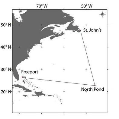

Location: Western flank of mid-Atlantic Ridge at 23°N, 46°W; Freeport (Bahamas) - St. John's (Canada)
Date: April 11, 2012 — May 10, 2012
Funding: DFG & BMBF
Participants from our group: Wolfgang Bach, Janis Thal
Summary: The research cruise is part of a larger international effort to investigate the origin and nature of microbial communities within basaltic basement below an isolated sediment "pond" located on 7–8 Ma seafloor on the western flank of the Mid-Atlantic Ridge at 23°N. The cornerstone of the program is a transect of borehole “CORKed” microbial observatories being designed to allow long-term (decadal), manipulative, community-based experiments, observations, and sampling. The primary goal of the cruise is the deployment and recovery of seafloor instrument packages on each of the three borehole observatories post drilling and to sample borehole fluids. We also plan to conduct ROV-based sediment sampling and heat flow measurements as well as mapping and rock sampling up the basement outcrops surrounding North Pond. These operations are critical to the success of the larger program aimed at studying the basalt-hosted biosphere. These studies will document and elucidate microbial community composition harbored within a young ridge flank, assess the role of microbes in the weathering of oceanic crust, and quantify relations between crustal hydrogeology and microbial community development. We closely cooperate with colleagues from the US, who have secured complete funding for building all of the borehole and wellhead instruments.
Location: Western flank of mid-Atlantic Ridge at 23°N, 46°W
Date: September 15, 2011 — November 16, 2011
Funding: IODP
Participants from our group: Wolfgang Bach
Summary: Installations of subseafloor observatories for monitoring fluid flow, geochemical exchange, and microbial activity were the primary focus of the cruise. Basalt and sediment cores were also retrieved and are currently studied in terms of linked microbial and geochemical processes.
Location: Eastern Manus Basin (Papua New Guinea); Townsville - Madang - Makassar
Date: June 14, 2011 — July 23, 2011
Funding: BMBF
Participants from our group: Wolfgang Bach, Niels Jöns, Eorghan Reeves, Liping Shu, Janis Thal
Summary: The expedition with R/VSONNE to the eastern Manus Basin of Papua New Guinea is aimed at sampling fluids, rocks and biota from hydrothermal systems in a back-arc environment. Furthermore, detailed bathymetric mapping has been undertaken.
Location: Oman Ophiolite Complex (northern Oman)
Date: February 14, 2011 — February 25, 2011
Participants from our group: Wolfgang Bach, Bastian Bieseler, Niels Jöns
Summary: During the field trip to the Oman Ophiolite Complex we sampled hydrothermally overprinted rocks from the exposed crustal cross-section to better understand the conditions and history of fluid through fast-spreading oceanic crust.