Researchers from the University of Bremen and the Federal Maritime and Hydrographic Agency have compared long-term data on the Atlantic Meridional Overturning Circulation from two different latitudes and discovered a statistical correlation. Their aim was to investigate how the Atlantic Meridional Overturning Circulation has developed over a period of 25 years, based on moored observation stations. This data will help to refine climate models in the future. The study has been published in the journal Geophysical Research Letters.
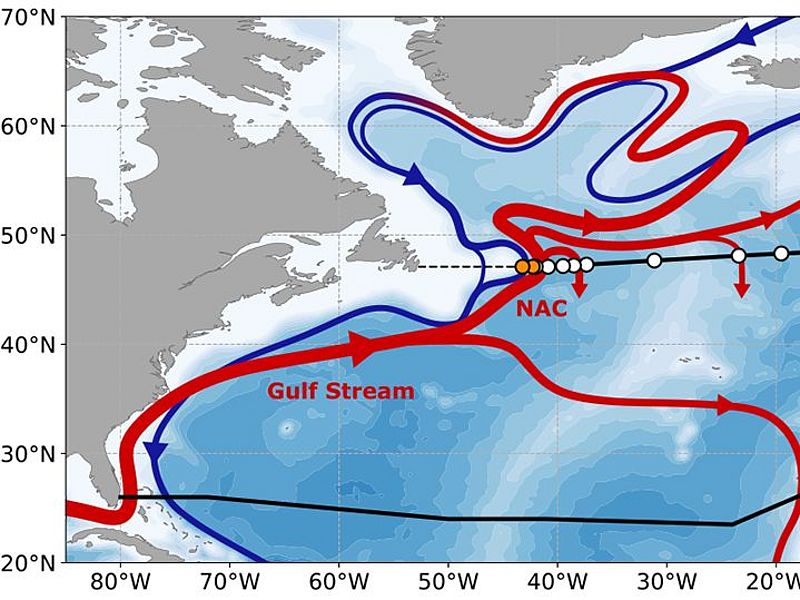
In addition to wind, temperature and salinity are the driving forces of ocean currents in the North Atlantic. They transport warm, salty water from the subtropical regions northward to the colder, lower-salinity areas. Like the wind-driven Gulf Stream, these currents are components of the Atlantic Meridional Overturning Circulation (AMOC). Because of the immense amount of heat it transports, the AMOC is an important part of the global climate system. For example, it influences regional precipitation as well as strong tropical storms, and acts as a remote heating system for Europe’s climate.
Long-term studies help to document changes and refine the mathematical models of future climate change. Modelling studies indicate that, in a warming world, the expected weakening of the AMOC could have an impact on regional temperature or precipitation patterns. Long-term observation systems have been in place, for example, at 26 degrees north latitude between the east side of Florida and the west coast of Africa. For the first time, researchers from Bremen and Hamburg have compared this data, covering a period of 25 years, with that from an observation system to the north at 47 degrees north between Newfoundland and France.
“We see a statistical connection,” says first author Simon Wett of MARUM – Center for Marine Environmental Sciences and the Institute of Environmental Physics at the University of Bremen. “There are parallels between the data from the two observation systems. Parts of what we observe in the data from our system during this extended time period, we also see a few months later at the 26-degree stations."
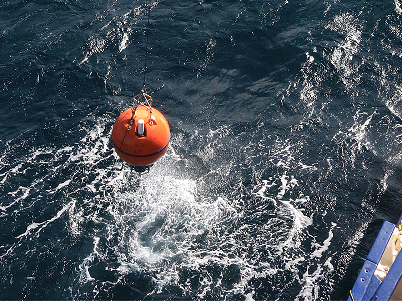
The long-term study, extending over the entire span of the Atlantic basin, is based on data from arrays of moorings that collect measurement parameters both near the surface of the ocean as well as at greater depths within the water column. These include, for example, the salinity, water temperature, and strength of the current. The moorings at 47°N were installed as a cooperative project between the University of Bremen and the Federal Maritime and Hydrographic Agency (BSH).
The researchers are convinced that a long time series provides a better foundation for future models to realistically simulate the AMOC. “Of course, we need to continue to monitor the AMOC in order to make long-term assessments and future prognoses,” says Simon Wett. A long-term trend of strengthening or weakening of the current could not be identified from the study by Wett and his colleagues, which covers the past quarter of a century.
Original publication:
Simon Wett, Monika Rhein, Dagmar Kieke, Christian Mertens, Martin Moritz: Meridional Connectivity of a 25-Year Observational AMOC Record at 47°N. Geophysical Research Letters 2023. DOI: https://doi.org/10.1029/2023GL103284
Participating institutes:
- Institute for Environmental Physics, University of Bremen, Germany
- MARUM – Center for Marine Environmental Sciences, University of Bremen, Germany
- Federal Maritime and Hydrographic Agency, Germany
Further information:
https://epoc.blogs.uni-hamburg.de/
Contact:
Simon Wett
MARUM – Center for Marine Environmental Sciences
Institute for Environmental Physics (IUP)
University of Bremen
Phone: +49 421 218-62159
Email: simon.wettprotect me ?!uni-bremenprotect me ?!.de